This blog aims to provide a comprehensive list of place names of the Cederberg area, with translations and, wherever possible, explanations and photographs. I am hoping to build this into something of a resource for Cederberg lovers as well as researchers. If you disagree with my interpretations, or have other ideas and names, please don’t hesitate to post your comments. Entries will be updated as new information comes to light.
The layout and general approach is similar to that in BEARD SHAVER’S BUSH: Place Names of the Western Cape by Ed Coombe and Peter Slingsby [Baardskeerder, 2000 [now sadly out of print]; the 1300+ names in this blog are from HIKE the CEDERBERG and do not cover as wide an area as our map CEDERBERG: the TOURING MAP .
Most letters of the alphabet have their own post below; some letters are doubled up to save space. Look at the Blog Archive on the right and click on the letter you need – this usually works better than simply scrolling down.
The list is now complete; however, we still need photos for many of the entries. If you are willing to let us use your pics [we only need 800 x 600 resolution] please contact us here .
All photos are copyright © to their authors; except where otherwise stated all photos are by Peter or Maggie Slingsby or Matthew Britton.

Cederberg Names
Sunday 28 July 2013
A
If you have any photographs of the entries in this blog that are not illustrated, or better pictures of those that are, and you are willing to let us have your minimum-res 800 x 600 pics, please contact us.
Adderley Street : Name sometimes given to the widest, easiest of the Wolfberg Cracks that can be hiked through without climbing; it is only faintly reminiscent of Adderley Street, the main street of the City of Cape Town ...
Af-en-Toe : “now and then” [Afr]; a holiday cottage on the Olifants River, owned by Arbeidsgenot Farm
Agter-Kruis Valley : “beyond the crossing valley” [Afr]; long valley of the Heks River, accessed from Algeria via path known as “Die Kruis” [“the crossing”]
Agter-Pakhuis : “beyond the Pakhuis” [Afr]; region reached from Clanwilliam after crossing over the Pakhuis Pass
Agter-Tafelbergpad : “beyond the Tafelberg path” [Afr]; path behind the Cederberg Tafelberg that descends eastwards to the village of Langkloof
 |
| Adderley Street, Wolfberg Cracks |
Af-en-Toe : “now and then” [Afr]; a holiday cottage on the Olifants River, owned by Arbeidsgenot Farm
Agter-Kruis Valley : “beyond the crossing valley” [Afr]; long valley of the Heks River, accessed from Algeria via path known as “Die Kruis” [“the crossing”]
 |
| The Agter-Pakhuis, from the Pakhuis Pass |
Agter-Tafelbergpad : “beyond the Tafelberg path” [Afr]; path behind the Cederberg Tafelberg that descends eastwards to the village of Langkloof
 |
| The Agter-Warmhoek waterfall |
Agter-Warmhoek : “the warm place beyond” [Afr]; named to distinguish it from Voor-Warmhoek, which means the “warm place in front”; valleys on either side of a nek between Grootkloof and Groot-Koupoort. Not to be confused with Warmhoek near Clanwilliam, the site for Living Landscape’s Rock Art Trail
Agterland : “the land beyond” [Afr]; a farm on the Olifants river a few kilometres north of Citrusdal
Agterstekop : “the hindmost hill” [Afr]; the last hill at the head of the Heuningvlei valley
Agterland : “the land beyond” [Afr]; a farm on the Olifants river a few kilometres north of Citrusdal
Agterstekop : “the hindmost hill” [Afr]; the last hill at the head of the Heuningvlei valley
 |
| Agterstevlei, looking northwards |
Agterstevlei : “the hindmost valley” [Afr]; tiny settlement over the hills west of Wupperthal
Agterstevleirivier : “river of the hindmost valley” [Afr]; stream running through above
Akkedisberg : “lizard mountain” [Afr]; hill near Bakkrans that resembles a lizard
Akkedisberg Pass : “lizard mountain pass” [Afr]; a pass over the above built by Arrie Beukes and others in the early 2000s
Alex se Platteklip : “Alex’s flat rock” [Afr]; a large flat rock west of Grysbokpunt, Middelberg, with a magnificent view down the Boskloof Valley; where Alex Basson took students to watch the sunset
Algeria : Originally “Garskraal” (“barley corral” [Afr]), it was renamed in 1905 at the request of Forester George Ernst Bath of England who could not pronounce “Garskraal”. The Cape Government chose ‘Algeria’ because the first superintendent of Forests, Graaf M de Vasselot de Regne, who had visited the area in 1882, had said that the Cederberg reminded him of the Atlas Mountains in Algeria
Algeria Peak : peak south-east of the Algeria forest station, 1511m
Allandale : farm between Citrusdal and Elandskloof, south of the R303
Alpha-Excelsior : farm and resort in the Agter-Pakhuis valley, also the home of the Pakhuys Country Winery
Alsfontein : “wormwood spring”, hence possibly “bitter spring” [Afr]; a long-abandoned farm and ruin in the Breekkrans valley, west of Vogelfontein
Amandelrivier : “almond river” [Afr]; a tributary of the Jan Dissels River, in upper Boskloof below Groot-Krakadouw. Named for the “bitter almond”, the fruit or drupe of the proteaceous shrub, Brabejum stellatifolium, which is not related to real almonds
Agterstevleirivier : “river of the hindmost valley” [Afr]; stream running through above
 |
| Akkedisberg Pass |
Akkedisberg Pass : “lizard mountain pass” [Afr]; a pass over the above built by Arrie Beukes and others in the early 2000s
Alex se Platteklip : “Alex’s flat rock” [Afr]; a large flat rock west of Grysbokpunt, Middelberg, with a magnificent view down the Boskloof Valley; where Alex Basson took students to watch the sunset
 |
| The Algeria campsite and drift over the Rondegat River; photo by David Fox |
Algeria Peak : peak south-east of the Algeria forest station, 1511m
Allandale : farm between Citrusdal and Elandskloof, south of the R303
 |
| Alpha-Excelsior, photographed from the Pakhuis Pass |
Alsfontein : “wormwood spring”, hence possibly “bitter spring” [Afr]; a long-abandoned farm and ruin in the Breekkrans valley, west of Vogelfontein
Amandelrivier : “almond river” [Afr]; a tributary of the Jan Dissels River, in upper Boskloof below Groot-Krakadouw. Named for the “bitter almond”, the fruit or drupe of the proteaceous shrub, Brabejum stellatifolium, which is not related to real almonds
 |
| Ambraal se Vrou |
Ambraal se Vrou : “Ambraal’s wife” [Afr]; a rock pillar near Heuningvlei resembling a standing woman. Who Ambraal was is not known
 |
| Amon se Kerk |
Amon se Kerk : “Amon’s church” [Afr]; a spire-shaped outcrop in Amon se Poort [vide]. Amon is an old Afrikaans reference to Satan
Amon se Kloof : “Amon’s ravine” [Afr]; a small ravine near Amon se Poort [vide]
Amon se Pad : “Amon’s path” [Afr]; path that leads to Amon se Poort, a part of the old wagon road near the summit of the Pakhuis Pass
Amon se Poort : “Amon’s pass” [Afr]; a ravine carrying the path between Pakhuis and Boskloof: also see “Duiwel se Kruis”. Amon is an old Afrikaans reference to Satan
Amon se Vlak : “Amon’s flats” [Afr]; the sandy flats traversed by Amon se Pad
Anvil Camp : A popular campsite in the lee of rocks, near The Anvil, on the western slopes of Skerpioensberg
Anyskloof : “aniseed ravine” [Afr]; named for a root, Annesorrhiza sp., or a buchu, anysboegoe (Agathosma capensis), both used to flavour food. A small ravine in the Olifants River Mountains, west of Petersfield, near Citrusdal
Apex Cave : A useful cave on Apex Peak, on the southern boundary of the Mountain Club property at Breekkrantz.
Apex Peak : Peak on the southern boundary of the Mountain Club property at Breekkrantz, 1627m; reason for the name unknown
Apollo Peak : Peak south of Disa Pool in the Kromrivier Valley, 1699m; reason for the name unknown
Appelkoospoort : “apricot pass” [Afr]; a small ravine between rock art sites 6 and 7 on the Sevilla Rock Art Trail; named for the [very poisonous] fruits of the gifappel plant (Solanum linnaeanum) which superficially resemble apricots, but also a play on the name of the late owner of Travellers’ Rest Farm, Koos Strauss
Arbeidsgenot : “joy in work” [Afr]; a farm on the Olifants River north of Citrusdal; growing there is what is reputed to be the oldest orange tree in the southern hemisphere (planted 1777)
Arch Peak : Peak due south of the Breekkrans Twins [see below], named for the proliferation of natural rock arches in the vicinity; 1563m
Amon se Kloof : “Amon’s ravine” [Afr]; a small ravine near Amon se Poort [vide]
Amon se Pad : “Amon’s path” [Afr]; path that leads to Amon se Poort, a part of the old wagon road near the summit of the Pakhuis Pass
Amon se Poort : “Amon’s pass” [Afr]; a ravine carrying the path between Pakhuis and Boskloof: also see “Duiwel se Kruis”. Amon is an old Afrikaans reference to Satan
Amon se Vlak : “Amon’s flats” [Afr]; the sandy flats traversed by Amon se Pad
Anvil Camp : A popular campsite in the lee of rocks, near The Anvil, on the western slopes of Skerpioensberg
Anyskloof : “aniseed ravine” [Afr]; named for a root, Annesorrhiza sp., or a buchu, anysboegoe (Agathosma capensis), both used to flavour food. A small ravine in the Olifants River Mountains, west of Petersfield, near Citrusdal
 |
| Apex Cave: photo by Carina Hanekom |
 |
| The view to the south east from Apex Peak, looking over Suurvlakte to the Koue Bokkeveld Sneeukop, highest peak in the range (2070m); photo by Carina Hanekom |
Apollo Peak : Peak south of Disa Pool in the Kromrivier Valley, 1699m; reason for the name unknown
Appelkoospoort : “apricot pass” [Afr]; a small ravine between rock art sites 6 and 7 on the Sevilla Rock Art Trail; named for the [very poisonous] fruits of the gifappel plant (Solanum linnaeanum) which superficially resemble apricots, but also a play on the name of the late owner of Travellers’ Rest Farm, Koos Strauss
Arbeidsgenot : “joy in work” [Afr]; a farm on the Olifants River north of Citrusdal; growing there is what is reputed to be the oldest orange tree in the southern hemisphere (planted 1777)
Arch Peak : Peak due south of the Breekkrans Twins [see below], named for the proliferation of natural rock arches in the vicinity; 1563m
 |
| Arrie’s Lookout on the Akkedisberg Pass; Arrie Beukes himself is on the left |
Arrie’s Lookout : A lookout point on the Akkedisberg Pass [see above], named for the pass-builder, Arrie Beukes
 |
| Arthur [left] and Martha in Krakadouwpoort |
Arthur : One of two rock pillars in Krakadouwpoort; as you ascend from the Heuningvlei side the pillar ahead of you appears to mark the summit, until when you reach Martha you realise that it’s Arthur that you really want ...
Asjas se Grot : “good-for-nothing’s cave” [Afr]; the Afrikaans word “asjas” means “good-for-nothing”, “ne’er-do-well” or “nincompoop” and in this context may refer to a donkey; a cave north-west of Sneeukop; there has also been a suggestion that Asjas was a freed slave, but I am still waiting for more info about this
Asjas se Kloof : “good-for-nothing’s ravine” [Afr]; see above – Asjas se Grot is in the ravine.
Asjas se Land : “good-for-nothing’s land or field” [Afr]; see above. Situated on the Citadel plateau north of Kouberg
Augsburg Landbougimnasium : “Augsburg Agricultural Gymnasium” [Afr]; an agricultural high school that in 1996 amalgamated with Clanwilliam High School. The 1 585 ha farm is outside Clanwilliam, in the shadow of Karookop. The farm was named by early German settlers after the Bavarian city of Augsburg, and predates the town of Clanwilliam by several decades
B
If you have any photographs of the entries in this blog that are not illustrated, or better pictures of those that are, and you are willing to let us have your minimum-res 800 x 600 pics, please contact us.
Bain’s Old Pakhuis Pass : Thomas Bain completed the original Pakhuis Pass in 1877. Most of the present road still follows his original alignment
Bakenskloof : “beacon ravine” [Afr]; named for the nearby house, “Die Baken”, which stands near the southern boundary beacon of Keurbosfontein farm
Bakkrans : “open cave” [Afr]; the Bakkrans is a large, shallow overhang in the side of an outcrop. It has rock paintings and modern inscriptions and lends its name to the entire Bakkrans Private reserve, in the Red Cederberg – the extreme eastern part of the Cederberg
Bakleikraal : “corral of the fight” [Afr]; at the western head of the Kromrivier valley. This circle of sheltering boulders is reputed to be the site of a skirmish between Boer and Brit in the South African War (1899–1902); this myth probably arose because of the presence of a British fort nearby. However, it is more likely to reflect an earlier engagement between white settlers and the indigenous Khoi or San
Bakmakersfontein : lit. “bowl/basin/dish maker’s spring” [Afr]; a subsistence farmer’s settlement in the Breekkrans Valley, now ruins. Ernst Hartwig writes: “The name ‘Bakmakersfontein’ ... refers to the craft of making a
botterbak (butter bowl or dish) from a waboom trunk. A botterbak, with a
matching botterspaan (butter scoop ) also made from waboom, was a widely used
household item at the Cape. Breekkrans could have provided an ample supply of
waboom. To this day there are many prime specimens of waboom trees in the
kloof. Their presence in the past is borne out by the name ‘Waboomskraal’,
further up along the Breekkrans River. Botterbakke of waboom were being made by
craftsmen of the Langkloof community until quite recently, if not to this day
still. I am the proud owner of a couple myself! So, it’s not far fetched to
picture a small botterbak industry at Bakmakersfontein, adding to the meager
income from subsistence farming, strategically located as it was along a major
highway from the Cape to Calvinia, the Ou Kaapse Weg, with the wagon of many a
smous passing by!”
Bakoondshoek : “oven corner” [Afr]; a corner in the Kromrivier valley, south of Dwarsrivierberg. Presumably so named because it is very hot there in summer
Balancing Rocks : A common place name, this one refers to a pile of huge boulders on “Die Noodpad”, the track between Heuningvlei and the Pakhuis Pass
Baliesgat : “tub hole” [Afr]; an isolated valley north of the Krakadouw Pass, presumably so named for its shape
Ballerjafontein : “wild mint spring” [Afr]; a spring on the southern side of the Kromrivier valley; Ernst Hartwig writes: ‘Ballerja is a perennial herb (Mentha longifolia, Eng. wild mint) used as a traditional medicine for various ailments. It only grows in wet places, which ties in with the ‘fontein’ bit.’
Banglyn : “frightening line” [Afr]; a reference to a cutline or firebreak that traversed fearful cliffs; the name is given to a (now very faint) path that linked the Skerpioenspoort path at Van Zylsklip to Boskloof at Agter-Warmhoek
Bassonsklip : “Basson’s rock” [Afr]; a cave frequented by Alex Basson and named for him by the Forestry Department workers with whom he explored the mountains; the cave once had a cedarwood floor, an outer wall and a door but these have disappeared in subsequent fires
Beesgat : “reed hole” [Afr]; Ernst Hartwig has pointed out that old accounts refer to the ‘Biesgat’, meaning a valley or defile where reeds or ‘biesies’ dominate the vegetation. It also apparent that this is the older name for the whole Breekkrans Valley, and not the parallel valley to the south; the latter is thus incorrectly named on the map and should rather be known as Dwarskloof, and the river as the Hondverbrandrivier. This is according to the local old timers, as Ernst Hartwig reports. However, ‘old timer’ Olive Nieuwoudt is one of the party who, according to Howes-Howell, is gazing down the Beesgat valley. His picture above is taken south of the Breekkrans Twins, in the ‘incorrect’ Beesgat. The two boulders in the pic are clearly visible on Google Earth at 32°35'01"S, 19°13'44"E.
1. the valley to the south of Breekkrans and parallel to it [in dispute]; 2. a campsite within the Breekkrans Valley.
Beesgat Rock Arch : As above; a rock arch on Apex Peak with a view down the Beesgat valley [could be incorrect]
Beesgatrivier : As above, the river or stream that runs down the Beesgat valley [could be incorrect]
Begrawe se Kloof : “bury ravine” [Afr]; a small ravine across the valley and facing the cemetery at the hamlet of Witwater
Bella’s : A rock art site at Bushmans Kloof, named after a dog belonging to the original resort developer, Bill McAdam
Berg en Dal : “mountain and vale” [Afr]; a farm with time-share and other holiday facilities, on the Middeldeur River near Kunje, Koue Bokkeveld
Bergsig : “mountain view” [Afr]; a farm south of the R303 near Kunje, Koue Bokkeveld
Bergsoom : “mountain’s edge” [Afr]; a farm in the Olifants River Mountains south of Citrusdal
Betjesfontein : “Betty’s spring” [Afr]; colloquial name for Elizabethsfontein in the Agter-Pakhuis. Betje [Elizabeth] was the original owner
Beukeskraal : “Beukes’ corral” [Afr]; a small hamlet in the Tra-Tra River valley, east of Wupperthal and part of the Mission Lands
Biedouw : “milk-bush pass” [Khoi]; named for the melkbos (geelmelkbos) or milk bush common in the area (probably Euphorbia mauritanica) which has poisonous sap; the actual pass was to the north-east of the present road down from Agter-Pakhuis. Biedouw farm was granted to the Lubbe brothers in 1750
Biedouw Guest Rooms : As above
Biedouw Hiking Trail : As above; the trail is on Mertenhof farm
Biedouw Jeugkamp : “Biedouw Youth camp” [Kh/Afr]; as above; the resort is on the upper Biedouw River
Biedouw River : As above; the river through the Biedouw Valley; by repute it harbours a mythical “water snake”
Biedouw River Canyon : Canyon on the Biedouw that divides Bushmans Kloof from Mertenhof farm
Biedouw se Gang : “Biedouw’s passage” [Kh/Afr] A cleft in the enormous rock pavements that fringe the south western edge of Bushmans Kloof; as the cleft does not lead to the Biedouw Valley the name does not make sense
Biedouw Valley : As above; the valley famed for its riot of spring flowers of all colours, in years of good rains
Biedouw Valley Rooibos Tea : A company that produces and packages rooibos tea, at Welbedacht farm
Biedouwberg : “Biedouw’s mountain” [Kh/Afr]; mountain to the north-east of the Biedouw Valley
Biesiefontein : “reeds or rushes spring” [Afr]; abandoned, ruined farm off the Wolfdrif road near Elizabethsfontein
Biesiefontein se Bult : “Biesiefontein’s rise” [Afr]; a rise in the Wolfdrif road near to the remains of Biesiefontein farm
Big Boulder Camp : A camp site amongst large rocks, near Crystal Pool
Black Fort : A bouldering site at Rocklands, not far from the summit of the Pakhuis Pass
Black Rocks : Prominent outcrops of black rocks, possibly manganese oxides, on the Klein-Koupoort path shortly before it intersects the Groot-Koupoort path
Bleeding Nose : A rock art site at Bushmans Kloof, famous for its shamanistic picture of a figure with a bleeding nose
Blind Corner : There are many blind corners on many trails; the name is applied to a place where the nature of the terrain, or the state of the path, makes it easy to overlook the correct route. The name thus serves as a warning to the hiker
Block Boulder : A very large, house-shaped boulder that is a landmark on the path between Boontjieskloof Hut and Skerpioenspoort
Block Hill : A prominent, block-shaped hill west of the path from Amon se Poort to Boskloof
Blokkop : “block hill” [Afr]; a prominent, block shaped hill east of Halfvelskop, near Heuningvlei Hut
Blomfontein : “flower spring” [Afr]; a perennial spring on the shale band south west of Corridor Peak
Blomfonteinkloof : “flower spring ravine” [Afr]; completely unrelated to the above, this very long ravine runs from Boskloof at its north western end to near Buffelspad, Middelberg at its south eastern end; origin unknown
Bloubosfontein : “blue bush spring” [Afr]; a sandy, sometimes wet and flat area off “Die Noodpad”, the road from Heuningvlei to Pakhuis Pass, possibly named for the occurrence of Lobostemon species in that area
Bloukop : “blue hill” [Afr]; a 1581m peak between Spinnekop and Sandfontein Peaks in the southern Cederberg
Bloukrans se Poort : “blue cliffs pass” [Afr]; a little known pass between Groot- and Klein-Koupoort, east of Crevasse Peak, that contains some of the finest surviving cedar trees in the area; named for the blue cliffs that look down upon the cedars on the eastern side
Blousteil : “blue scarp” [Afr]; a very steep incline where the Wupperthal 4 x 4 trail crosses the flank of the Vaalheuningberg on the northern side, near Beukeskraal; fatal accidents have occurred
Blousteilte : “blue steep” [Afr]; a very steep incline on the eastern side of Bain’s old Pakhuis Pass, now disused. Bain imported a special blue-chip stone to surface his road at this point, to make it less slippery in wet weather
Bloutuin : “blue garden” [Afr]; a plot or “land” upstream from Sevilla on the Brandewyn River, used for various crops and sometimes planted with blue lupins to increase its fertility
Bloutuin se Dam : “blue garden dam” [Afr]; dam or weir upstream from the former, forming the lead-off point for a water-furrow, aqueduct and/or siphon that carries water for many miles downstream to Lorraine farm and beyond
Bo-Boskloof : “upper bushy ravine” [Afr]; the upper part of Boskloof, the very long ravine traversed by the Jan Dissels River, that runs from Crystal Pool all the way to Clanwilliam
Bo-Driffie : “above the little drift” [Afr]; a small rocky amphitheatre in Geelhoutskloof on Jamaka farm, literally “above the little drift on the main road”. In the old days the rooibos tea gatherers would dry their crop here, and the tea-cutters would bring their cutting machine to this point to cut the long stems into fragments
Bo-Fonteinskloof : “upper springs ravine” [Afr]; a minor ravine on the western slopes of Duiwelskop, north of Citrusdal
Bo-Kruis : “above the crossing” [Afr]; the upper end of the Kruisrivier ravine, on the path between Algeria and Heks River
Bo-Martiensrust : “upper Martin’s rest” [Afr]; settlement near Langloof; Martiensrust itself is nearly 200m lower down at the bottom of the Moordenaarsgat ravine
Bobbejaanfontein : “baboon spring” [Afr]; a fresh water spring above the Brandewyn River, north west of Bushmans Kloof
Bobbejaankop : “baboon hill” [Afr]; a small rocky hill at Kromrivier farm
Bobbejaanspoort : “baboon’s pass” [Afr]; a small, deep ravine in the hills behind the Sevilla cottages, in the Agter-Pakhuis
Bobbejane se Kop : “baboons’ hill” [Afr]; a small hill near Brugkraal, a hamlet on the Wupperthal Mission lands
Bokdrif : “buck drift” [Afr]; a drift across the Breekkrans River a few kilometres downstream from Nuwerust farm and resort
Bokdrif Trail : As above, a trail that crosses the river at Bokdrif
Bokveldskloof : “goat veldt’s ravine [Afr] [possibly a corruption of “Bokvelskloof”= “goatskin ravine”]; a ravine on the farm Dwarsrivier on the eastern side of Sneeuberg, near the Maltese Cross path
Boontjies River : “little beans river” [Afr]; the “beans” or “boontjies” refer to the drupes or fruits of the proteaceous Wild Almond plant, Brabejum stellatifolium. There are two Boontjies Rivers in the area, one a major tributary of the Olifants River east of Citrusdal, and another a small tributary of the Brandewyn River in the Agter-Pakhuis
Boontjiesberg : “little beans mountain” [Afr]; a 699m peak near Hoek se Berg on the Wupperthal road. This is not the right habitat for the traditional “boontjies” [see above] and is possibly named because it is the mountain between Hoek se Berg and Boontjieskloof farm, the original name of the Bushmans Kloof resort
Boontjieskloof : “little beans ravine” [Afr]; the “beans” or “boontjies” refer to the drupes or fruits of the proteaceous Wild Almond plant, Brabejum stellatifolium. There are two Boontjieskloofs in this area; one is a ravine near Grasvlei, a Wupperthal outlier, where a mountain hut [see below] is located; the other is the ravine where Bushmans Kloof resort is located, and which was the original name of the farm there
Boontjieskloof Hut : See the entry above
Boontjiespoort : “little beans pass” [Afr]; a ravine near Kleinfontein farm, Agter-Pakhuis, where the last Cederberg ‘riethuis’ was located (burnt in 2012)
Boontjiesrivier : See Boontjies River above
Boschkloof : “bushy ravine” [Afr]; a ravine near Citrusdal that has a British fort from the South African War (1899–1902). The Dutch spelling “bosch” distinguishes this ravine from “Boskloof”, which is near Clanwilliam
Boschkloof Footpath : See above; the footpath that ascends the ravine
Boschkloof Mountain Bike Trail : A trail on the farm of the same name: see above
Bosdorp : “forest village” [Afr]; the name given to the village in Grootkloof that was originally erected to house workers from the Algeria Forest Station. See also “Witkamp”
Boshoek : “bushy corner” [Afr]; enormous, deep amphitheatre above Algeria, west of Protea Peak
Boshof : “bushy garden” [Afr], but also a fairly common surname; a farm near Kriedouw on Nieuwoudt’s Pass
Boskloof : “bushy ravine” [Afr]; a very long ravine, the valley of the Jan Dissels River that extends from Clanwilliam deep into the Cederberg, near Crystal Pool; not to be confused with “Boschkloof” [see above], which is near Citrusdal
Boskloof Day Walk : See above; a path from the Pakhuis Pass via Amon se Poort to Boskloof, that can easily be walked in a day
Boskloof Pinnacle : See above; a round-topped, free-standing peak east of The Dome and north of Middelberg North, 1159m
Boskloof Swemgat : “bushy ravine swimming hole” [Afr]; a popular resort in the Boskloof known for its large pool in the Jan Dissels River
Boskloofsrivier : “bushy ravine river” [Afr]; the river that runs down the Boschkloof; confusingly, it is seldom spelled in the old Dutch style
Bosman Peak : Bosman is an Afrikaans surname; in this context we do not know who Bosman was. A 1501m peak north of Frustration Peak, in the MCSA’s Breekkrantz property
Bosplaas : “bushy farm or place” [Afr]; a farm flanking the R303 where it crosses the Boontjies River, near Citrusdal
Bosplaat se Kloof : “ravine of the bushy place” [Afr]; the ravine that exits the enormous Boshoek amphitheatre, towards Algeria
Botha se Berg : “Botha’s mountain” [Afr]; a hill that measures exactly 1000m above mean sea level, south-east of the summit of the Pakhuis Pass; Botha se Berg was named after the first owner of Pakhuis Farm, back in the 1800’s – when according to the title deeds the name was still spelled the German way – Both.
Bottom Gully : Gully on the north-west side of Skerpioensberg, on one of the preferred ascent routes
Boulder Camp : Campsite at Filander se Werf, on the footpath from Warmhoek to Middelberg
Bovlei Guest Farm : “upper valley guest farm” [Afr]; popular resort in the Boskloof near Clanwilliam
Braambosfontein : “bramble bush spring” [Afr]; ruins of abandoned farm near Sandfontein and Kunje, in the southern Cederberg
Brabejum Stream : Stream with dense wild almond bushes (Brabejum stellatifolium), on the Pakhuisberg Day Walk, north of the Kliphuis campsite
Brakfontein : “salty or alkaline spring” [Afr]; one of the oldest farms outside Citrusdal on the northern side; granted to the German settler Barend Frederik Lubbe in 1758; at the time the name was spelled ‘Brackefonteyn’. Brakfontein is also a kraal on the Karoobergpad, in the Matjies Rivier Nature Reserve [see below]
Brakfontein se Hoog : “salty spring hill” [Afr]; a high point on the Karoobergpad in the Matjies Rivier Nature Reserve, near Brakfontein kraal
Brandekraal Leopard Trap : “burning kraal” [Afr]; an old stone leopard trap on the Breekkrans River, below Nuwerust farm
Brandewynrivier : “brandy river” [Afr]; the explanation that the river was named for a place where an encampment of British soldiers left the place strewn with brandy bottles is entirely fanciful. The Olivier’s old family farm in the Agter-Pakhuis was “Drilrivier” [= quicksand river]. Barend Olivier was the first farmer to irrigate vines from the river; he also owned the only brandy still in the Agter-Pakhuis. By repute he was rather fond of his own product; it is said that when Barend was on the binge his wife would walk around the outside of the house, bible in hand, praying that the walls would fall on the old man! However, a recent discovery is that the name was originally applied to the farm now known as De Pakhuys, which probably puts old Barend Olivier out of the picture, too
Brandhoek : “burning corner” [Afr]; at Bushmans Kloof, it is a rock art site presumably named for a veld fire that once burned there. Also an old kraal in the Bakkrans Private Reserve
Brandhoek Dam : As above; a dam near Brandhoek at Bushmans Kloof
Brandhoekskloof : “burning corner ravine” [Afr]; a kloof above the eponymous kraal, at Bakkrans Reserve. This one is surely named for the extreme summer heat in the area
Brandkraal : “burning corral” [Afr]; in the early 1800’s Jan Matthys Kok was a missionary for the London Missionary Society at Vogelfontein, near the present Nuwerus. Kok was attracted to the settlements further north and left. In anger his Khoi congregants set fire to the mission. To this day many Cederberg residents still refer to the area as ‘Brandkraal’
Breekkrans : “broken cliff” [Afr]; in 1884, after a week of heavy rain, there was a great rumbling noise followed by a shudder that felt like an earth tremor. The residents of Kromrivier rode out to see what had happened; they saw that a kranz on the ridge to the south had collapsed. The property, the river, and the twin peaks near the head of the valley are all known as “Breekkrans ...” as a result, although the fall itself is known as “Die Breek”. There is a different but less-famous Breekkrans in the hills west of Travellers’ Rest, formed after a similar event
Breekkrans Arch : As above; a rock arch on Moorrees Peak [1524m], just above Die Breek
Breekkrans Trail : As above, but in this instance this trail is near the Travellers’ Rest Breekkrans
Breekkrans Twins : As above; twin peaks at the head of the Breekkrans Valley, on the southern side; 1579m and 1587m in height
Breekkrans Valley : As above; the valley of the Breekkrans
Breekkransberge : “broken cliff mountains” [Afr]; generic name of the mountains south of the Breekkrans Valley
Breekkranskloof : As above; synonym for Breekkrans Valley
Breekkransrivier : As above, the river in the Breekkrans Valley
Breekkrantz : As above, the official name of the Mountain Club property that includes Die Breek, the spelling is Durch
Breëwaterkloof : “wide water ravine” [Afr]; a small, shallow ravine near the summit of the Uitkyk Pass, to the south west
Brug se Kloof : “bridge’s ravine” [Afr]; tiny ravine to the south west and opposite the narrow bridge on the Clanwilliam road, just out of Algeria
Brugklip : “bridge rock” [Afr]; a bridge-like rock arch that looks down on the Uitkyk resort at the head of the Grootfloof/Algeria valley
Brugklip Rock Arch : As above
Brugkraal : “bridge corral” [Afr]; a tiny settlement near Heuningvlei and Witwater, a part of the Wupperthal Mission; it is across the river from the access road, but there is no bridge ...
Brugkraal se Kop : “bridge corral’s hill” [Afr]; hill due north of Brugkraal, 1026m
Bruinman se Voetpad : “brown man’s footpath” [Afr]; a footpath leading out of the Brandewyn River valley towards the Pakhuis Pass, a short-cut used by pedestrian traffic to avoid the Oupoort bends. Pedestrians in that area tend to be ‘brown’ people, hence the name
Bruinrug : “brown ridge” [Afr]; a ridge due north of the Citadel in the Tra-Tra Mountains, possibly named for the colour of the soil there
Bruintjiesfontein se Kloof : “little brown’s spring ravine” [Afr]; ‘Bruintjies’ is possibly the name of a person or an animal; this is a very long valley that links Kleinplaas farm near the Middelberg Pass, to the Boschkloof near Citrusdal
Buffelshoek : “buffalo’s corner” [Afr]; named for the historical occurrence of Cape Buffalo there (Syncerus caffer); a farm at the foot of the Middelberg Pass [R303] on the eastern side. This side of the pass is often referred to as the ‘Buffelshoek Pass’
Buffelspad : “buffalo’s road” [Afr]; as above; a farm north of Buffelshoek, off the Middelberg Pass
Burgemeester : “mayor” [Afr]; a large boulder at the junction of the Kromrivier-Breekkrans path and the Breekkrans-Vogelfontein path (the latter has almost disappeared); the rock fancifully resembles the large, frowning head of a man
Burgershalt : “citizen’s halt” [Afr]; more probably named after someone called Burger, this is a small farmstead near Elizabethsfontein in the Agter-Pakhuis
Burgerskloof : “Burger’s ravine” [Afr]; a minor ravine near the large wetland, Die Vlei, that lies between Driehoek and Eikeboom in the central valley of the Cederberg
Bushmans Kloof : Formerly ‘Boontjieskloof’, the farm was renamed by the McAdam family when they established an upmarket resort there. The etymology is unusual.
Bushmans Kloof Mountain Trail : As above
Bushmans Kloof Wilderness Reserve and Retreat : As above
Bydidam : “at the dam” [Afr]; commercial shortening of the Afrikaans “by die dam”; a resort on the R303 near Citrusdal, on the shores of a dam
Baadjieskraal : “coat or jacket-corral” [Afr] – but probably named after an individual named “Baadjies”, a common South African surname. An abandoned farm (now ruined) south of the R303 between Citrusdal and Elandskloof
 |
| The sign marking the Bobbejaan Gat in Sas se Kloof |
Baboon Gate : A self-closing gate on sprung hinges on the path between Kleinvlei and Wupperthal, where it passes through Sas se Kloof. Presumably designed to contain sheep, the gate effectively seals the only passage past the deep pool in the river below, the “Bobbejaan Gat” as marked on the rocks nearby
Bain’s Old Cape Road : The road built by Thomas Bain between Citrusdal and Clanwilliam; it follows the right or eastern bank of the Olifants River and near Rondegat farm has been partially inundated by the Clanwilliam Dam. Bain surveyed and built the road after he had completed Grey’s Pass (now replaced by Piekenierskloof Pass) in 1858Bain’s Old Pakhuis Pass : Thomas Bain completed the original Pakhuis Pass in 1877. Most of the present road still follows his original alignment
Bakenskloof : “beacon ravine” [Afr]; named for the nearby house, “Die Baken”, which stands near the southern boundary beacon of Keurbosfontein farm
 |
| The Bakkrans |
 |
| The view down the Kromrivier valley, from the SA War fort near Bakleikraal |
 |
| The ruins at Bakmakersfontein; Breekkrans in the distance |
Bakoondshoek : “oven corner” [Afr]; a corner in the Kromrivier valley, south of Dwarsrivierberg. Presumably so named because it is very hot there in summer
Balancing Rocks : A common place name, this one refers to a pile of huge boulders on “Die Noodpad”, the track between Heuningvlei and the Pakhuis Pass
Baliesgat : “tub hole” [Afr]; an isolated valley north of the Krakadouw Pass, presumably so named for its shape
Ballerjafontein : “wild mint spring” [Afr]; a spring on the southern side of the Kromrivier valley; Ernst Hartwig writes: ‘Ballerja is a perennial herb (Mentha longifolia, Eng. wild mint) used as a traditional medicine for various ailments. It only grows in wet places, which ties in with the ‘fontein’ bit.’
Banglyn : “frightening line” [Afr]; a reference to a cutline or firebreak that traversed fearful cliffs; the name is given to a (now very faint) path that linked the Skerpioenspoort path at Van Zylsklip to Boskloof at Agter-Warmhoek
Bassonsklip : “Basson’s rock” [Afr]; a cave frequented by Alex Basson and named for him by the Forestry Department workers with whom he explored the mountains; the cave once had a cedarwood floor, an outer wall and a door but these have disappeared in subsequent fires
 |
| Howes-Howell’s 1958 picture captioned ‘Beesgat vlaktes’. The left-most figure is Olive Nieuwoudt; the two rocks are clearly visible on Google Earth |
1. the valley to the south of Breekkrans and parallel to it [in dispute]; 2. a campsite within the Breekkrans Valley.
 |
| Beesgat Rock Arch, 21st Century: pic by Andricus van der Westhuizen |
 |
| Beesgat Rock Arch, 1958: pic by Ken Howes-Howell; the imperative to stand on that rock goes back a long way ... |
Beesgatrivier : As above, the river or stream that runs down the Beesgat valley [could be incorrect]
Begrawe se Kloof : “bury ravine” [Afr]; a small ravine across the valley and facing the cemetery at the hamlet of Witwater
 |
| Some of the images at Bella's |
Berg en Dal : “mountain and vale” [Afr]; a farm with time-share and other holiday facilities, on the Middeldeur River near Kunje, Koue Bokkeveld
Bergsig : “mountain view” [Afr]; a farm south of the R303 near Kunje, Koue Bokkeveld
Bergsoom : “mountain’s edge” [Afr]; a farm in the Olifants River Mountains south of Citrusdal
Betjesfontein : “Betty’s spring” [Afr]; colloquial name for Elizabethsfontein in the Agter-Pakhuis. Betje [Elizabeth] was the original owner
Beukeskraal : “Beukes’ corral” [Afr]; a small hamlet in the Tra-Tra River valley, east of Wupperthal and part of the Mission Lands
 |
| Biedouw farm; granted in 1750, the house dates from 1788 |
Biedouw Guest Rooms : As above
Biedouw Hiking Trail : As above; the trail is on Mertenhof farm
 |
| Biedouw Jeugkamp, from the Wupperthal road |
Biedouw River : As above; the river through the Biedouw Valley; by repute it harbours a mythical “water snake”
Biedouw River Canyon : Canyon on the Biedouw that divides Bushmans Kloof from Mertenhof farm
Biedouw se Gang : “Biedouw’s passage” [Kh/Afr] A cleft in the enormous rock pavements that fringe the south western edge of Bushmans Kloof; as the cleft does not lead to the Biedouw Valley the name does not make sense
 |
| Biedouw Valley in spring |
Biedouw Valley Rooibos Tea : A company that produces and packages rooibos tea, at Welbedacht farm
Biedouwberg : “Biedouw’s mountain” [Kh/Afr]; mountain to the north-east of the Biedouw Valley
 |
| Ruins at Biesiefontein |
Biesiefontein se Bult : “Biesiefontein’s rise” [Afr]; a rise in the Wolfdrif road near to the remains of Biesiefontein farm
 |
| Big Boulder Camp |
Big Boulder Camp : A camp site amongst large rocks, near Crystal Pool
Black Fort : A bouldering site at Rocklands, not far from the summit of the Pakhuis Pass
Black Rocks : Prominent outcrops of black rocks, possibly manganese oxides, on the Klein-Koupoort path shortly before it intersects the Groot-Koupoort path
 |
| Black Rocks |
 |
| The famous ‘bleeding nose’ painting at the rock art site of that name |
Blind Corner : There are many blind corners on many trails; the name is applied to a place where the nature of the terrain, or the state of the path, makes it easy to overlook the correct route. The name thus serves as a warning to the hiker
Block Boulder : A very large, house-shaped boulder that is a landmark on the path between Boontjieskloof Hut and Skerpioenspoort
Block Hill : A prominent, block-shaped hill west of the path from Amon se Poort to Boskloof
 |
| Blokkop |
Blomfontein : “flower spring” [Afr]; a perennial spring on the shale band south west of Corridor Peak
Blomfonteinkloof : “flower spring ravine” [Afr]; completely unrelated to the above, this very long ravine runs from Boskloof at its north western end to near Buffelspad, Middelberg at its south eastern end; origin unknown
 |
| Bloubosfontein refers to the open vlakte in the foreground |
Bloukop : “blue hill” [Afr]; a 1581m peak between Spinnekop and Sandfontein Peaks in the southern Cederberg
Bloukrans se Poort : “blue cliffs pass” [Afr]; a little known pass between Groot- and Klein-Koupoort, east of Crevasse Peak, that contains some of the finest surviving cedar trees in the area; named for the blue cliffs that look down upon the cedars on the eastern side
Blousteil : “blue scarp” [Afr]; a very steep incline where the Wupperthal 4 x 4 trail crosses the flank of the Vaalheuningberg on the northern side, near Beukeskraal; fatal accidents have occurred
Blousteilte : “blue steep” [Afr]; a very steep incline on the eastern side of Bain’s old Pakhuis Pass, now disused. Bain imported a special blue-chip stone to surface his road at this point, to make it less slippery in wet weather
Bloutuin : “blue garden” [Afr]; a plot or “land” upstream from Sevilla on the Brandewyn River, used for various crops and sometimes planted with blue lupins to increase its fertility
Bloutuin se Dam : “blue garden dam” [Afr]; dam or weir upstream from the former, forming the lead-off point for a water-furrow, aqueduct and/or siphon that carries water for many miles downstream to Lorraine farm and beyond
Bo-Boskloof : “upper bushy ravine” [Afr]; the upper part of Boskloof, the very long ravine traversed by the Jan Dissels River, that runs from Crystal Pool all the way to Clanwilliam
 |
| Bo-Driffie |
Bo-Fonteinskloof : “upper springs ravine” [Afr]; a minor ravine on the western slopes of Duiwelskop, north of Citrusdal
Bo-Kruis : “above the crossing” [Afr]; the upper end of the Kruisrivier ravine, on the path between Algeria and Heks River
Bo-Martiensrust : “upper Martin’s rest” [Afr]; settlement near Langloof; Martiensrust itself is nearly 200m lower down at the bottom of the Moordenaarsgat ravine
Bobbejaanfontein : “baboon spring” [Afr]; a fresh water spring above the Brandewyn River, north west of Bushmans Kloof
Bobbejaankop : “baboon hill” [Afr]; a small rocky hill at Kromrivier farm
Bobbejaanspoort : “baboon’s pass” [Afr]; a small, deep ravine in the hills behind the Sevilla cottages, in the Agter-Pakhuis
Bobbejane se Kop : “baboons’ hill” [Afr]; a small hill near Brugkraal, a hamlet on the Wupperthal Mission lands
Bokdrif : “buck drift” [Afr]; a drift across the Breekkrans River a few kilometres downstream from Nuwerust farm and resort
Bokdrif Trail : As above, a trail that crosses the river at Bokdrif
Bokveldskloof : “goat veldt’s ravine [Afr] [possibly a corruption of “Bokvelskloof”= “goatskin ravine”]; a ravine on the farm Dwarsrivier on the eastern side of Sneeuberg, near the Maltese Cross path
Boontjies River : “little beans river” [Afr]; the “beans” or “boontjies” refer to the drupes or fruits of the proteaceous Wild Almond plant, Brabejum stellatifolium. There are two Boontjies Rivers in the area, one a major tributary of the Olifants River east of Citrusdal, and another a small tributary of the Brandewyn River in the Agter-Pakhuis
Boontjiesberg : “little beans mountain” [Afr]; a 699m peak near Hoek se Berg on the Wupperthal road. This is not the right habitat for the traditional “boontjies” [see above] and is possibly named because it is the mountain between Hoek se Berg and Boontjieskloof farm, the original name of the Bushmans Kloof resort
Boontjieskloof : “little beans ravine” [Afr]; the “beans” or “boontjies” refer to the drupes or fruits of the proteaceous Wild Almond plant, Brabejum stellatifolium. There are two Boontjieskloofs in this area; one is a ravine near Grasvlei, a Wupperthal outlier, where a mountain hut [see below] is located; the other is the ravine where Bushmans Kloof resort is located, and which was the original name of the farm there
 |
| Boontjieskloof Hut |
 |
| Boontjiespoort; the distant mountain on the left is Oompie se Kop |
Boontjiesrivier : See Boontjies River above
 |
| The SA War fort in Boschkloof |
Boschkloof Footpath : See above; the footpath that ascends the ravine
Boschkloof Mountain Bike Trail : A trail on the farm of the same name: see above
 |
| Bosdorp |
Boshoek : “bushy corner” [Afr]; enormous, deep amphitheatre above Algeria, west of Protea Peak
Boshof : “bushy garden” [Afr], but also a fairly common surname; a farm near Kriedouw on Nieuwoudt’s Pass
Boskloof : “bushy ravine” [Afr]; a very long ravine, the valley of the Jan Dissels River that extends from Clanwilliam deep into the Cederberg, near Crystal Pool; not to be confused with “Boschkloof” [see above], which is near Citrusdal
Boskloof Day Walk : See above; a path from the Pakhuis Pass via Amon se Poort to Boskloof, that can easily be walked in a day
 |
| Boskloof Pinnacle |
Boskloof Swemgat : “bushy ravine swimming hole” [Afr]; a popular resort in the Boskloof known for its large pool in the Jan Dissels River
Boskloofsrivier : “bushy ravine river” [Afr]; the river that runs down the Boschkloof; confusingly, it is seldom spelled in the old Dutch style
Bosman Peak : Bosman is an Afrikaans surname; in this context we do not know who Bosman was. A 1501m peak north of Frustration Peak, in the MCSA’s Breekkrantz property
Bosplaas : “bushy farm or place” [Afr]; a farm flanking the R303 where it crosses the Boontjies River, near Citrusdal
Bosplaat se Kloof : “ravine of the bushy place” [Afr]; the ravine that exits the enormous Boshoek amphitheatre, towards Algeria
Botha se Berg : “Botha’s mountain” [Afr]; a hill that measures exactly 1000m above mean sea level, south-east of the summit of the Pakhuis Pass; Botha se Berg was named after the first owner of Pakhuis Farm, back in the 1800’s – when according to the title deeds the name was still spelled the German way – Both.
Bottom Gully : Gully on the north-west side of Skerpioensberg, on one of the preferred ascent routes
 |
| Boulder Camp |
Bovlei Guest Farm : “upper valley guest farm” [Afr]; popular resort in the Boskloof near Clanwilliam
Braambosfontein : “bramble bush spring” [Afr]; ruins of abandoned farm near Sandfontein and Kunje, in the southern Cederberg
 |
| The fruits of Brabejum stellatifolium, sometimes called boontjies, ghô-boon or even teddy bear eggs ... |
Brakfontein se Hoog : “salty spring hill” [Afr]; a high point on the Karoobergpad in the Matjies Rivier Nature Reserve, near Brakfontein kraal
Brandekraal Leopard Trap : “burning kraal” [Afr]; an old stone leopard trap on the Breekkrans River, below Nuwerust farm
 |
| The Brandewyn River in flood, 29 July 2001; the Traveller’s Rest Farm Stall might have been feeling a little nervous! |
 |
| Some of the rock art figures at Brandhoek |
Brandhoek Dam : As above; a dam near Brandhoek at Bushmans Kloof
Brandhoekskloof : “burning corner ravine” [Afr]; a kloof above the eponymous kraal, at Bakkrans Reserve. This one is surely named for the extreme summer heat in the area
Brandkraal : “burning corral” [Afr]; in the early 1800’s Jan Matthys Kok was a missionary for the London Missionary Society at Vogelfontein, near the present Nuwerus. Kok was attracted to the settlements further north and left. In anger his Khoi congregants set fire to the mission. To this day many Cederberg residents still refer to the area as ‘Brandkraal’
 |
| Breekkrans in 2011 |
 |
| Breekkrans Arch: photo by Ken Howes-Howell, 1958 |
Breekkrans Trail : As above, but in this instance this trail is near the Travellers’ Rest Breekkrans
 |
| Breekkrans Twins; photo by Ken Howes-Howell, November 1937 |
Breekkrans Valley : As above; the valley of the Breekkrans
Breekkransberge : “broken cliff mountains” [Afr]; generic name of the mountains south of the Breekkrans Valley
Breekkranskloof : As above; synonym for Breekkrans Valley
Breekkransrivier : As above, the river in the Breekkrans Valley
Breekkrantz : As above, the official name of the Mountain Club property that includes Die Breek, the spelling is Durch
Breëwaterkloof : “wide water ravine” [Afr]; a small, shallow ravine near the summit of the Uitkyk Pass, to the south west
Brug se Kloof : “bridge’s ravine” [Afr]; tiny ravine to the south west and opposite the narrow bridge on the Clanwilliam road, just out of Algeria
 |
| Brugklip Arch, above Uitkyk. This very large arch is extremely difficult to see against the rocky mountain slopes; we have shaded the background above the arch to make it stand out a little. To the east of the Uitkyk cottages |
Brugklip Rock Arch : As above
 |
| Brugkraal, with Sneeukop in the distance |
Brugkraal se Kop : “bridge corral’s hill” [Afr]; hill due north of Brugkraal, 1026m
Bruinman se Voetpad : “brown man’s footpath” [Afr]; a footpath leading out of the Brandewyn River valley towards the Pakhuis Pass, a short-cut used by pedestrian traffic to avoid the Oupoort bends. Pedestrians in that area tend to be ‘brown’ people, hence the name
Bruinrug : “brown ridge” [Afr]; a ridge due north of the Citadel in the Tra-Tra Mountains, possibly named for the colour of the soil there
Bruintjiesfontein se Kloof : “little brown’s spring ravine” [Afr]; ‘Bruintjies’ is possibly the name of a person or an animal; this is a very long valley that links Kleinplaas farm near the Middelberg Pass, to the Boschkloof near Citrusdal
Buffelshoek : “buffalo’s corner” [Afr]; named for the historical occurrence of Cape Buffalo there (Syncerus caffer); a farm at the foot of the Middelberg Pass [R303] on the eastern side. This side of the pass is often referred to as the ‘Buffelshoek Pass’
Buffelspad : “buffalo’s road” [Afr]; as above; a farm north of Buffelshoek, off the Middelberg Pass
 |
| Burgemeester rock |
Burgershalt : “citizen’s halt” [Afr]; more probably named after someone called Burger, this is a small farmstead near Elizabethsfontein in the Agter-Pakhuis
Burgerskloof : “Burger’s ravine” [Afr]; a minor ravine near the large wetland, Die Vlei, that lies between Driehoek and Eikeboom in the central valley of the Cederberg
Bushmans Kloof : Formerly ‘Boontjieskloof’, the farm was renamed by the McAdam family when they established an upmarket resort there. The etymology is unusual.
Bushmans Kloof Mountain Trail : As above
Bushmans Kloof Wilderness Reserve and Retreat : As above
Bydidam : “at the dam” [Afr]; commercial shortening of the Afrikaans “by die dam”; a resort on the R303 near Citrusdal, on the shores of a dam
C
If you have any photographs of the entries in this blog that are not illustrated, or better pictures of those that are, and you are willing to let us have your minimum-res 800 x 600 pics, please contact us.
Caleta Cove : A resort area off the Clanwilliam–Algeria road, on the shores of the Clanwilliam Dam; apparently named after Sa-Caleta Cove, on the Spanish Mediterranean coast, which it does not resemble in any way whatsoever (see photo above)
Calvinia : Rural town in the Northern Cape Province, at the foot of the Hantam mountains; named after John Calvin, the protestant reformer, in 1851
Camp Sallie : A boulderer’s campsite at the De Pakhuys resort, in the Agter-Pakhuis; origin unknown. Possibly named by a homesick American boulderer after Camp Salie, a resort within the Martin-Island-Linwood Lakes Regional Park in Minnesota?
Cape Leopard Trust Environmental Camp : An environmental education centre for children and adults, originally established by Elizabeth Martins at Matjiesrivier in the Cederberg, and operated under the aegis of the Cape Leopard Trust
Cape Leopard Trust Research Base : Base for research into the endangered Cape leopard, Panthera pardus, oiginally under the leadership of Quinton Martins; at Matjiesrivier
Cascade Pools : Pools near the head of the Rondegat River, at the Uitkyk resort complex operated by Cape Nature
Castle Rock : Bouldering site near the summit of the Pakhuis Pass, off Amon se Poort
Cathedral Rocks : Well-known rock formation on the Middelberg plateau, between Algeria Peak and Jurie se Berg; also known as the Organ Pipes
Cave Bee : A rock art site at Bushmans Kloof, distinguished by the presence of tiny, fruit-fly-sized bees that leave smears of tar-like honey on the cave roof
Cedar Peak : A 1691m peak that lies between Krakadouw and Chisel Peak
Cedar Rock : A reserve and resort in the Red Cederberg, on the farm Zuurfontein [“sour spring”, Afr]
Cederberg : A Cape mountain range that, it is normally accepted, stretches from the Grootrivier in the south to the Pakhuis Pass in the north; named for the endemic presence of the endangered cypress, Widdringtonia wallachi. The spelling ‘Ceder-’, which is ‘low’ Nederlands or Dutch, appears on written documents from the 1700s and maps from as early as 1900: cf the Farm Survey map of the Clanwilliam area, made by the Field Intelligence Unit under Capt Casgram of the British Army
Cederberg Cellar : Wine cellar at Dwarsrivier farm in the central Cederberg
Cederberg Cottage : Resort near Kriedouw at the western end of Nieuwoudt’s Pass
Cederberg Heritage Route : An organization that runs a series of guided trails that encourage the participation of the less-advantaged communities of the outlying Wupperthal Mission hamlets as guides, donkey-cart drivers, accommodation and meal providers, etc.
Cederberg Oasis : A resort and restaurant in the eastern Cederberg near the farm Vogelfontein; formerly known as Fontein-Meriba. The latter name comes from the biblical account wherein Moses strikes the rock, causing water to gush from it; ‘meribah’ means ‘the quarrel’, hence ‘spring of the quarrel’
Cederberg Wilderness : Proclaimed on 27 July 1973, the Cederberg Wilderness covers more-or-less the State Forest area known as the Cederberg. Wilderness status (proclaimed in terms of an Act of Parliament) means that the area must be conserved as far as possible in its original condition, etc etc. Whether the status has benefitted the rapidly-disappearing cedar trees is doubtful
Cederfontein Mineral Water Bottling Plant : An abandoned building between Vogelfontein and Grootrivier; it appears to be an enterprise that never took off
Cederhoutkloof : “cedarwood ravine” [Afr]; the ravine that leads to Hoogvertoon from Eikeboom, in the central Cederberg, presumably an old logging track
Cederhoutkop : “cedarwood hill” [Afr]; a 974m peak in the Pakhuisberge where presumably cedars once grew; there were no cedars there by the 1980s when Rudolf Andrag completed his cedar tree survey
Cederpark : An accommodation facility for farm workers off the R303, near Kunje
Ceres : A major town in the Warm Bokkeveld, on the R303 route to the southern Cederberg. Senator G. Munnik gave the name to the farm he bought in 1854, where the town now stands; Ceres was the Roman goddess of agriculture. The weather forecasting service yr.no provides reports for no less than 86 places named Ceres around the world ....
Chaos : A 1560m+ peak south of Sandfontein Peak in the southern Cederberg, known for its difficult jumble of massive boulders
Charity : One of three peaks north of the summit of the Pakhuis Pass, the others being Faith and Hope, and named by C. Louis Leipoldt; Charity tops out at 1087m, almost exactly the same height as Cape Town’s Table Mountain. Contrary to popular belief the peaks are not named after three local sisters
Charlie Brown : A rock art site at Bushmans Kloof, a shallow shelter that is partially inundated when the Main Dam there is full; named after a dog belonging to Mark McAdam, son of the founder of Bushmans Kloof
Chisel Peak : A 1716m peak south of Cedar Peak and north of Koupoort Peak, on the eastern side of the Clanwilliam Boskloof
Chockstone : A huge boulder wedged between adjacent rock pillars or buttresses, forming an arch or doorway of considerable height and width; on the southern side of Middleberg North, it may have been named by Ferdi Fischer in the 1960s
Citadel : An extraordinary peak in the Tra-Tra mountains south of Biedouw, formed by a single straight line of very large, upright boulders, resembling the walls of a citadel or fort and extending over nearly four hundred metres in length. It is one of the ‘iconic’ peaks of the Agter-Pakhuis area in that it is visible in almost every view. It is also known to the local residents as ‘Tandjiesberg’ [‘mountain of little teeth’] for its resemblance to a line of teeth, or as ‘Sydekel’, a corruption of ‘Citadel’
Citadel Kop : As above
Citrusdal : A town on the south western edge of the Cederberg, founded in 1916 on a portion of the farm Middelpost to act as a spiritual and commercial centre for the local farming district.
Citrusdal Air Field : As above; for many years it was a base for the Western Province Parachute Club; with the call sign ‘FACI’, it is currently closed
Citrusdal Cellars : As above; a local cooperative wine cellar
Clanwilliam : A town on the north western edge of the Cederberg, it is one of the older towns in the Western Cape, with a community established before 1800 under the name ‘Jan Disselsvlei’, after the river that runs past it. It was formally established as a town in 1806 and renamed by governor Sir John Cradock on 1st January 1814 after his father-in-law, the Duke of Clanwilliam
Clanwilliam Dam : As above; the dam was completed in 1935 as part of the Trawal-Klawer irrigation scheme, and the wall was raised by six metres in 1966; there are currently proposals to raise the wall by another 15 metres, which will have a considerable effect on the Olifants River Valley, and the roads in the area, especially the N7 and the Cederberg access road via Nieuwoudt’s Pass. Construction of the new dam has been halted for several years [as of 2021] because the required funds were apparently stolen by persons involved in the relevant government department ...
Clay Dam : A small dam at Bushmans Kloof
Consolation Peak : A peak of 1759m south west of the Cederberg Tafelberg, and possibly so named as it is an easier option for those who fail to make the ascent of Tafelberg itself
Corridor Peak : A peak of 1838m south east of the Cederberg Tafelberg, known for the deep cracks and ‘corridors’ on its summit
Country House : An accommodation facility outside Citrusdal on its northern side
Crack Caverns : A series of small cave shelters and cracks just west of the summit of Klein-Koupoort, also sometimes known as the ‘Whistling Caves’ for the effect of strong winds there
Crevasse Peak : A twin peak of 1606m and 1626m that is divided by a deep crevasse; between Klein-Koupoort and Groot-Koupoort
Crystal Pool : A pool on the north-western slopes of Sneeukop; it is a well-known landmark on the main footpath between Uilsgat and Skerpioensberg and a favourite camping area. By repute the area is haunted by the ghost of the ‘Engelsman’, the unknown English soldier after whom the nearby ravine that leads to Sneeukop is named, and who was reputedly killed there by Boers who fired a small cannon at him, which blew off his head. His grisly ghost flits around Crystal Pool in the moonlight apparently seeking its head ... some have also claimed that there is ‘something in the water’ at Crystal Pool, but I prefer the former story
Crystal Pool Hut : As above, the old foresters’ hut near the pool and which provides an uncomfortable but dry shelter in bad weather
Crystal Pools : A series of pools in the upper reaches of the Boontjieskloof River, outside the Bushmans Kloof boundary; it is unfortunate that the same name as the pool above has been adopted for these by unknown but clearly unimaginative persons
Cyster se Grot : “Cyster’s cave” [Afr]; Cyster was a semi-hermit who reputedly bought the property just south of the present-day Bushmans Kloof from the Wupperthal Mission, for five pounds; thereafter he lived alone in the cave for many years until a house was built for him nearby. He died there in the 1990s when he was more than 100 years old. As the land is now part of the Mission Lands it seems more likely that Cyster merely purchased a lifelong lease rather than the actual property
Cyster se Werf : “Cyster’s place” [Afr]; as above, the house where Cyster died. ‘Cyster’ is pronounced ‘sayster’
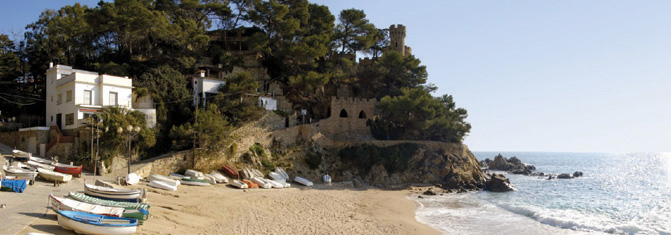 |
| Sa-Caleta Cove, on the Mediterranean: the website blurb says: ‘Sa Caleta is located next to Lloret Beach. It stretches below a castle that enjoys lovely views. Small boats are clustered along the shore.’ Nice as it is, the Clanwilliam Dam was never like this ... |
Calvinia : Rural town in the Northern Cape Province, at the foot of the Hantam mountains; named after John Calvin, the protestant reformer, in 1851
Camp Sallie : A boulderer’s campsite at the De Pakhuys resort, in the Agter-Pakhuis; origin unknown. Possibly named by a homesick American boulderer after Camp Salie, a resort within the Martin-Island-Linwood Lakes Regional Park in Minnesota?
Cape Leopard Trust Environmental Camp : An environmental education centre for children and adults, originally established by Elizabeth Martins at Matjiesrivier in the Cederberg, and operated under the aegis of the Cape Leopard Trust
 |
| Cape leopard: Panthera pardus |
 |
| Cascade Pools |
Castle Rock : Bouldering site near the summit of the Pakhuis Pass, off Amon se Poort
 |
| Cathedral Rocks |
 |
| Some of the more bizarre rock art figures at Cave Bee cave |
Cedar Peak : A 1691m peak that lies between Krakadouw and Chisel Peak
Cedar Rock : A reserve and resort in the Red Cederberg, on the farm Zuurfontein [“sour spring”, Afr]
 |
| A fine specimen of the Cederberg ‘cedar’, Widdringtonia wallachi; this one was photographed by Ken Howes-Howell near the Middelberg Hut in January 1941. The tree has gone; more significant, if you look closely, are the thousands of young cypress seedlings that surround this giant in all directions. They, too, have gone ... |
Cederberg Cellar : Wine cellar at Dwarsrivier farm in the central Cederberg
Cederberg Cottage : Resort near Kriedouw at the western end of Nieuwoudt’s Pass
Cederberg Heritage Route : An organization that runs a series of guided trails that encourage the participation of the less-advantaged communities of the outlying Wupperthal Mission hamlets as guides, donkey-cart drivers, accommodation and meal providers, etc.
Cederberg Oasis : A resort and restaurant in the eastern Cederberg near the farm Vogelfontein; formerly known as Fontein-Meriba. The latter name comes from the biblical account wherein Moses strikes the rock, causing water to gush from it; ‘meribah’ means ‘the quarrel’, hence ‘spring of the quarrel’
Cederberg Wilderness : Proclaimed on 27 July 1973, the Cederberg Wilderness covers more-or-less the State Forest area known as the Cederberg. Wilderness status (proclaimed in terms of an Act of Parliament) means that the area must be conserved as far as possible in its original condition, etc etc. Whether the status has benefitted the rapidly-disappearing cedar trees is doubtful
Cederfontein Mineral Water Bottling Plant : An abandoned building between Vogelfontein and Grootrivier; it appears to be an enterprise that never took off
 |
| Cederhoutkloof; the view upstream |
Cederhoutkop : “cedarwood hill” [Afr]; a 974m peak in the Pakhuisberge where presumably cedars once grew; there were no cedars there by the 1980s when Rudolf Andrag completed his cedar tree survey
Cederpark : An accommodation facility for farm workers off the R303, near Kunje
Ceres : A major town in the Warm Bokkeveld, on the R303 route to the southern Cederberg. Senator G. Munnik gave the name to the farm he bought in 1854, where the town now stands; Ceres was the Roman goddess of agriculture. The weather forecasting service yr.no provides reports for no less than 86 places named Ceres around the world ....
Chaos : A 1560m+ peak south of Sandfontein Peak in the southern Cederberg, known for its difficult jumble of massive boulders
 |
| Faith, Hope (partly obscured) and Charity (on the right) |
 |
| The line of chubby ladies at Charlie Brown |
Chisel Peak : A 1716m peak south of Cedar Peak and north of Koupoort Peak, on the eastern side of the Clanwilliam Boskloof
 |
| Chockstone; Ferdi Fischer in the view |
 |
| Citadel, Tandjiesberg or Sykadel |
Citadel Kop : As above
Citrusdal : A town on the south western edge of the Cederberg, founded in 1916 on a portion of the farm Middelpost to act as a spiritual and commercial centre for the local farming district.
Citrusdal Air Field : As above; for many years it was a base for the Western Province Parachute Club; with the call sign ‘FACI’, it is currently closed
Citrusdal Cellars : As above; a local cooperative wine cellar
 |
| Clanwilliam, in about 1870; note the gaol at the end of the street [without palm trees!] |
 |
| The Clanwilliam Dam photographed by Ken Howes-Howell in 1958, before the wall was raised by six metres to the present level |
Clay Dam : A small dam at Bushmans Kloof
Consolation Peak : A peak of 1759m south west of the Cederberg Tafelberg, and possibly so named as it is an easier option for those who fail to make the ascent of Tafelberg itself
 |
| Deep cracks on Corridor Peak; photo by Graham Bellairs |
Country House : An accommodation facility outside Citrusdal on its northern side
 |
| Inside the Crack Caverns |
Crevasse Peak : A twin peak of 1606m and 1626m that is divided by a deep crevasse; between Klein-Koupoort and Groot-Koupoort
 |
| Crystal Pool on a dark, spooky afternoon |
 |
| Crystal Pool Hut |
Crystal Pools : A series of pools in the upper reaches of the Boontjieskloof River, outside the Bushmans Kloof boundary; it is unfortunate that the same name as the pool above has been adopted for these by unknown but clearly unimaginative persons
Cyster se Grot : “Cyster’s cave” [Afr]; Cyster was a semi-hermit who reputedly bought the property just south of the present-day Bushmans Kloof from the Wupperthal Mission, for five pounds; thereafter he lived alone in the cave for many years until a house was built for him nearby. He died there in the 1990s when he was more than 100 years old. As the land is now part of the Mission Lands it seems more likely that Cyster merely purchased a lifelong lease rather than the actual property
Cyster se Werf : “Cyster’s place” [Afr]; as above, the house where Cyster died. ‘Cyster’ is pronounced ‘sayster’
Subscribe to:
Posts (Atom)